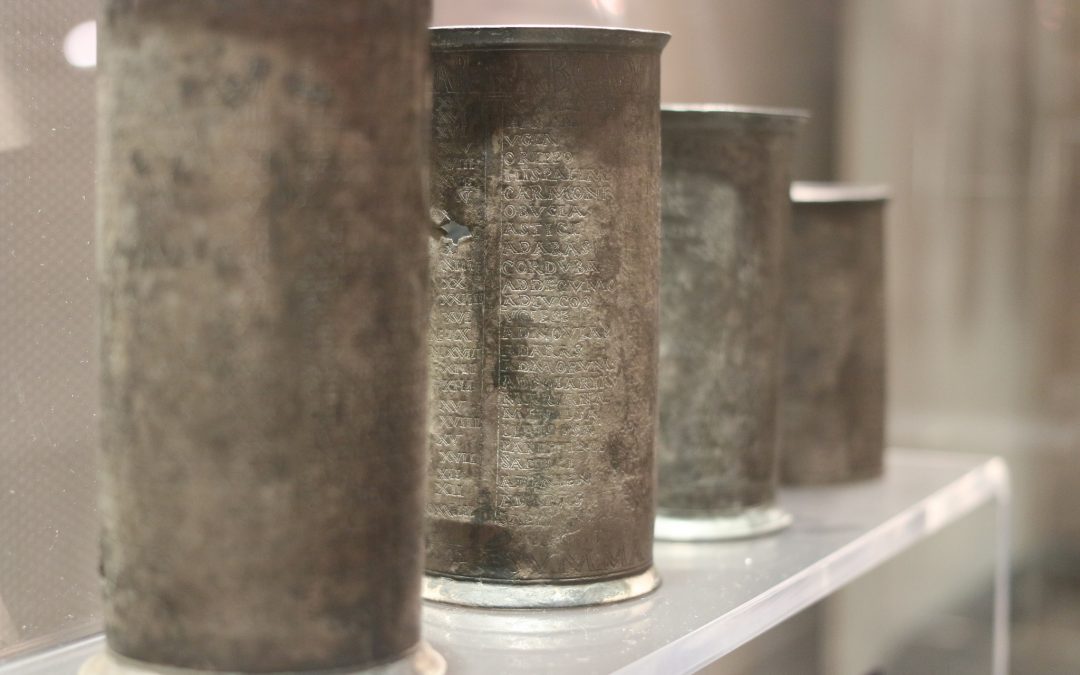
The pipeline method for linked open road data and the creation of the gazetteer will be tested through a model focused on the Roman Roads of the Iberian Peninsula. This case was selected due to the diversity and richness of the resources as well as the availability of the most up-to-date knowledge on these routes through the Mercator-e project led by Pau de Soto. In these territories we can find different Roman roads attested in ancient written and depicted sources such as the Vicarello Cups, the Itinerarium Antonini Augusti, and the Tabula Peutingeriana. The Mercator-e project additionally collected all archaeological and historical traces of all route segments to create the most accurate and up-to-date digital resource of physical routes in the Roman Iberian Peninsula. However, this dataset is not currently linked open data.
Through the Itiner-e gazetteer and the places associated with routes, this data resource will be linked with other Gazetteer projects such as Pleiades (https://pleiades.stoa.org/) and the TIR-FOR Project (https://tir-for.iec.cat/the-map/). All the data generated will be stored in GeoJson format where all the information will be stored (id names, places within the roads, chronology, etc…)